
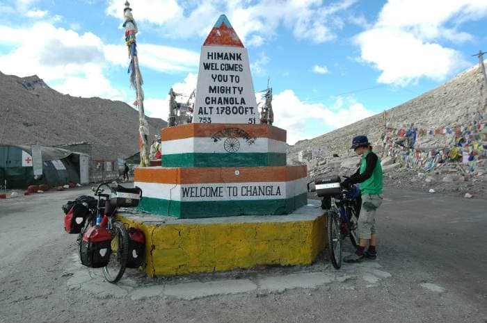
Photo spot in Pangong Tso
Chang La
Pangong Tso, Ladakh
One of the world's highest motorable passes (~5,360 m) on the road from Leh to Pangong, marked by prayer flags, a small shrine and snow even in summer.
Best time
Late morning on the way to the lake, when the sun lights the snow and prayer flags; early afternoon on the way back, before cloud and wind build.
Best angle
Stand a few steps below the pass signboard and take a photo up towards the prayer flags, with the snow slopes behind and army vehicles kept out of the frame.
Entry fee
Free
Opening hours
Daylight (seasonal)
Crowd level
Medium
Best outfit colors
Overview
Best time to visit Chang La
Late morning on the way to the lake, when the sun lights the snow and prayer flags; early afternoon on the way back, before cloud and wind build. Crowds here are typically medium. Arrive a little early to claim your angle and catch the softest light before the day tips over.
Poses & angles
Photo tips for Chang La
Stand a few steps below the pass signboard and take a photo up towards the prayer flags, with the snow slopes behind and army vehicles kept out of the frame. Work a few of the pose ideas below, shoot wide for context and tight for detail, and give yourself a couple of extra minutes to get the frame right.
At the pass marker
Among the prayer flags
Outfit guide
What to wear at Chang La
For photos at Chang La, red, black and white work beautifully — they stand out against the setting without fighting it. Pick one hero colour and keep the rest of the look calm so you stay the subject of the frame.
Best outfit colors for photos
Trending wear for this spot
Popular modern looks travellers are wearing across Pangong Tso.
Traditional wear for this spot
Timeless, cultural looks that suit Chang La.
Eat nearby
Food near Chang La
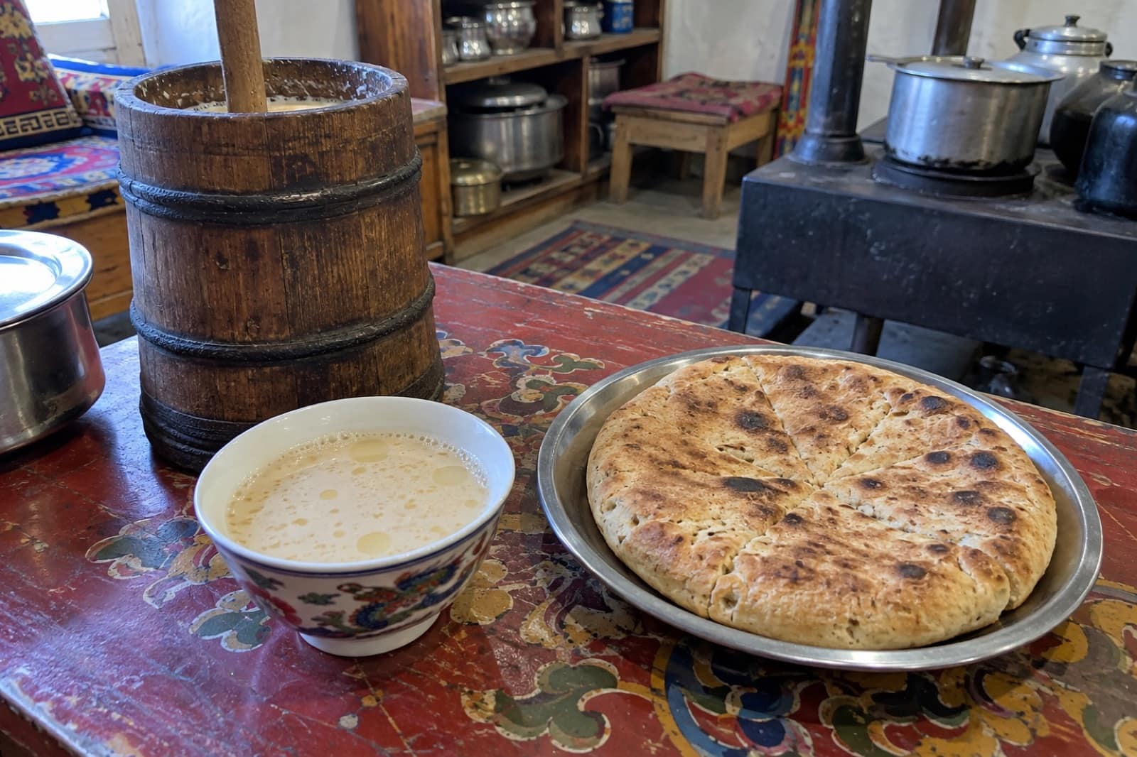
Round out the visit with something to eat. Look for butter tea nearby, or settle in at one of the 1 restaurants close by.
Special dishes to try
Restaurants & food places nearby
Search food by craving
Good to know
Local tips
Limit your stop at the top to about 20 minutes because of the altitude.
Put on your jacket, hat and gloves before you step out of the car.
Leave Leh early so you cross before meltwater streams rise in the afternoon.
Walk slowly and do not climb the slopes above the road.
Drink water on the way up and carry a small snack.
Keep army vehicles, posts and soldiers out of your photos.
Check in Leh whether the pass is open after any snowfall.
The pass
Chang La is the high pass on the road from Leh to Pangong Tso, roughly halfway between the two. Its height is given as about 5,360 m, though signs and sources differ. The top is marked by prayer flags, a small shrine and, on most days, snow on the slopes around. It is one of the highest roads most visitors will ever drive.
The altitude
The air at the top holds far less oxygen than at sea level. Doctors advise staying no more than 20 to 25 minutes. Walk slowly, avoid climbing the slopes for a better view, and get back in the car if you feel dizzy, sick or short of breath. Headaches that start here usually ease on the way down to the lake. This is why you must spend 48 hours acclimatising in Leh first.
The road
The climb from Zingral on the Leh side is steep, with many hairpin bends. For 10 to 15 km on either side of the top, the road can be broken, muddy and crossed by meltwater streams in summer, especially in the afternoon. The descent towards Tangtse is also steep. Leave Leh early to cross before the streams rise.
At the top
There is a small army-run tea point where you can get tea and Maggi and warm up. Toilets are basic. Keep army vehicles, posts and soldiers out of your photos.
In winter
The pass is kept open for army supplies, but heavy snow can close it for hours or days. Check the road status in Leh before a winter trip.
On the way
Takthok and Chemrey monasteries near Sakti, below the Leh side of the pass, make good stops on the same drive.
Questions
Chang La — FAQ
What is the best time to visit Chang La?
Late morning on the way to the lake, when the sun lights the snow and prayer flags; early afternoon on the way back, before cloud and wind build. Stand a few steps below the pass signboard and take a photo up towards the prayer flags, with the snow slopes behind and army vehicles kept out of the frame.
Is there an entry fee at Chang La?
Entry to Chang La is free.
What are the opening hours of Chang La?
Chang La is open daylight (seasonal).
What should I wear at Chang La?
Red, black and white photograph especially well here. Explore the trending and traditional outfit ideas on this page for full looks.
How crowded does Chang La get?
Crowd levels are typically medium. To miss the busiest window: late morning on the way to the lake, when the sun lights the snow and prayer flags; early afternoon on the way back, before cloud and wind build.
What food should I try near Chang La?
Try butter tea, available at nearby restaurants.
How high is Chang La?
It is usually given as about 5,360 m, though signs and other sources quote slightly different heights.
How long can I stay at Chang La?
Doctors advise no more than 20 to 25 minutes at the top because of the altitude.
Is Chang La open in winter?
It is kept open for army supplies, but heavy snowfall can close it for a time. Check in Leh before you set out.
Is the road over Chang La difficult?
It is steep with many hairpin bends, and near the top it can be broken and crossed by meltwater streams in summer.